FARO AS-BUILT FOR AUTOCAD® SOFTWARE: VERSATILE REALITY-TO-CAD SOLUTIONS
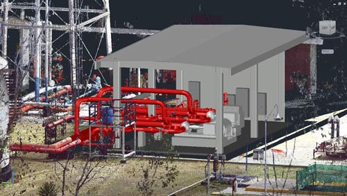
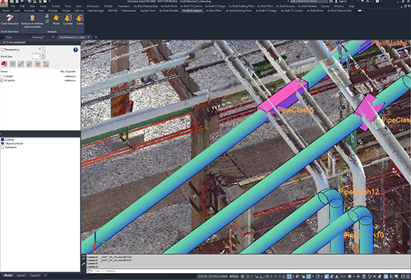
Whether modeling infrastructure design, 2D building plans, industrial and MEP facilities, excavations or calculating orthophotos from point cloud data, the FARO As-Built Modeler Software together with the additional plugin for AutoCAD Software performs the job. Equipped with a comprehensive set of easy to handle features it extends the native AutoCAD point cloud functionality with versatile and useful tools for point cloud processing. FARO As-Built for AutoCAD Software enables the flexible and efficient modeling and documentation of building elements and inventory, piping systems and steel construction, terrain and civil engineering projects such as tunnels, bridges or highways. Next to its pure point cloud functionality the software offers photogrammetic functionality. High definition, oriented photos (originally taken from digital cameras) support the processing of the laser scanner data and allow the fast construction of 3D wireframe models and surfaces. A compatible interface for total stations enables the range of functions and generates the staking out of points from design into reality.
 ∷
∷ 


 Sweep WeChat yards pay attention to us